Transportation
Virtual Map Counter
|
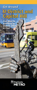
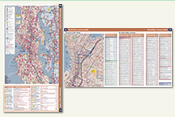
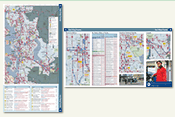
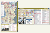
Get Around Your Neighborhood! Use this map to travel by bus, light rail, streetcar, bike and foot to visit interesting places and services in your neighborhood. Find out how close you are to parks, schools, libraries, local businesses, community services, and so much more! Leave your car at home and try a new way of getting around! Go here for complete information and access to PDF files of this two-sided map brochure, including geospatial PDFs—take the map with you on your mobile device, locate yourself in real time, record waypoints and tracks, and more. |
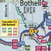
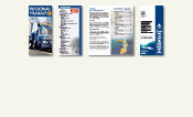
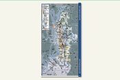
front cover back cover sample map detail |
Print Size See below for viewing/download options for all or part of the map book. See also: Vashon Island Road Map, 2016 Edition, an enhanced mosaic of the Vashon/Maury Island Road Index maps. (Scroll down to the bottom of this page to find its listing.) |
The Washington State Administrative Code (WAC 136-60) mandates the maintenance of an annually updated county road log. "Mobility!" is a database of road characteristics which counties use for this purpose. This map series contains 47 individual maps, including a countywide index. All of the maps are available below as individual Adobe Acrobat PDF files and in a single Acrobat file that contains the entire map book. Published February 2016. Questions concerning this map series should be directed to: |
|
Map Book Files |
|
|
Note: very large file—176Mb. |
Index Map |
|
Map 1 |
Map 1 (Northeast King County) Map 1A (Snoqualmie) Map 1B (North Bend) Map A (Skykomish) |
Map 2 |
Map 2 (Northwest King County) Map 2A (Shoreline) Map 2B (White Center) Map 2C (Sea-Tac Airport) Map 2D (Kenmore/Woodinville) Map 2E (Juanita) Map 2G (Mercer Island) Map 2H (Renton/Bryn Mawr) Map 2J (Renton/Fairwood) Map 2K (Woodinville/Cottage Lake) Map 2L (Redmond/North Lake Sammamish) Map 2M (Bellevue/South Lake Sammamish) Map 2N (East Renton/Lake Kathleen/Lake Desire) Map 2P (Duvall/Novelty Hill) Map 2Q (Sammamish/Redmond Ridge) Map 2R (Sammamish/Klahanie) Map 2S (Issaquah/Tiger Mountain/ Mirrormont) Map 2T (East Duvall/Lake Margaret/ Stossel Creek) Map 2U (Carnation/Lake Joy/Lake Marcel) Map 2V (South Carnation/Ames Lake/ North Fall City) Map 2W (Fall City/Snoqualmie/ Preston) |
Map 3 |
Map 3 (Southwest King County) Map 3A (Kent/Des Moines/Star Lake) Map 3B (Federal Way/North Lake/ Pierce County Boundary Map 3C (Kent/Auburn/East Hill) Map 3D (Auburn/Algona/Pacific) Map 3E (Lake Youngs/Covington/ East Kent) Map 3F (South Covington/Lake Morton/ Green River) Map 3G (Muckleshoot Indian Reservation/West Enumclaw) Map 3H (Maple Valley/East Covington) Map 3J (Black Diamond/South Maple Valley/Lake Sawyer) Map 3K (Enumclaw/White River) Map 3M (Kanaskat/Kangley/ Landsburg) Map 3N (Cumberland/Veazey/Green River Gorge) |
Map 4 |
Map 4 (Southeast King County) |
Vashon/Maury Island Maps Map V1 (North Vashon Island) Map V2 (South Vashon Island) Map V3 (Maury Island) See also: Vashon Island Road Map, 2016 Edition, an enhanced mosaic of the Vashon/Maury Island Road Index maps. (Scroll down to the bottom of this page to find its listing.) |
|
King County Road Maintenance Districts and Shops |
|
King County Urban Growth Area and WSDOT Urbanized Area |
|
2016 King County Legislative Districts |
|
2016 King County Council Districts |
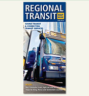
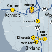
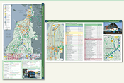
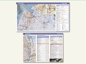
regional map sample fare-zone map sample |
February 2014 Edition |
*This product appears here courtesy of Sound Transit. ©2014 Sound Transit, all rights reserved. |
|
Print Size See below for viewing/download options for all or part of the booklet. |
|
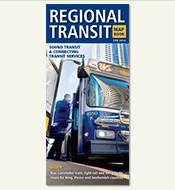
The “Regional Transit Map Book” is a 24-page collection of regional and local transit maps, service information, and provider contacts. It functions as both a high-level regional overview of public transportation options, and a convenient starting point for transit trip planning within the Sound Transit service area. Booklet features include a region-wide map that delineates the three-county Sound Transit District, and a separate larger-scale map for each of the five Sound Transit service subareas. The subarea maps depict all Sound Transit routes and the connecting local bus routes. Additional maps show even more detail for key urban transit locales. The maps are supplemented by tables of transit facilities, such as transit centers and park-and-ride lots, as well as the transit service options available at each facility. Bus route tables identify the routes depicted on the maps by number, description, and hours of service. Contact information for nearly twenty Puget Sound area transit service providers ensures ready access to the full range of regional travel options, including online trip planning services. The "Regional Transit Map Book" was conceived and developed by Sound Transit (external link) with cartographic and booklet design, layout, and production contracted to the King County GIS Center and executed by its Client Services team. Printed copies of the booklet are available at many transit locations throughout the service area. First edition: June 2006, second edition: February 2008, third edition: October 2010. |
|
Map Book Files |
|
Complete booklet: Regional Transit Map Book |
|
|
Partial booklet: cover and text-only pages |
Map: Central Puget Sound Service Area |
|
|
Maps & tables: Snohomish County |
|
Maps & tables: North King County / Seattle |
|
Maps & tables: East King County |
|
Maps & tables: South King County |
|
Maps & tables: Pierce County |
Print Size: 60 x 90 inches — 12Mb PDF This map can be printed at a reduced scale but it is not designed to be legible when printed to desktop printers. The map scale is 1:9,600 or 1 inch to 800 feet (when printed at the original page size). |
|
This map is an enhanced combination of the three King County Road Index maps that cover Vashon Island. Additional features in this version include parcels, shaded relief, land elevation and bathymetric color tints, bathymetric contours, and custom annotation features (i.e., label text) designed for a scale of 1:10,000. Published March 2016. Questions concerning the Road Index map series should be directed to: |