
 Translate
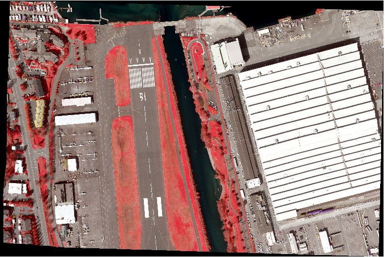
Orthophotography data
Overview
The King County GIS Spatial Data Warehouse (KCGIS SDW) stores orthophotography and satellite imagery of multiple vintages, resolutions, and extents. Data is available in natural color, panchromatic (B&W), and multispectral formats, though not all versions are available for each dataset. Please refer to the descriptions below, and metadata where available, for more information about each dataset.
Due to the particular conditions contained in various licensing agreements, not all datasets are available for release to the public or agencies and cities outside of King County government. Data may be made available, with restrictions, to consultants and other parties operating under contract or other formal agreement with King County. Availability of data to other outside parties is included in the product listings on this page.
For data which King County is permitted to release, we can assist you in selecting the correct data and format for your needs, and in providing a cost-estimate for data preparation and media delivery. All imagery requests require submission of a Custom Data Request form in order for staff to properly estimate the effort needed to provide the data. The King County GIS Center can also assist you in contacting the original source or vendor for data that we are not permitted to redistribute.
Imagery datasets are available in various formats, resolutions and tiling schemes. Depending on your business needs, you may choose from the following.
- Losslessly compressed 7500-foot tiles
- Township-range tiles where the data is stored in a minimally-lossey image format
- A seamless, project-wide mosaic dataset in which the imagery retains its native resolution
Quadrant file mosaics at the zone tiling level are also available. Plus, each dataset is stored as a single file mosaic in the SDW keyregion directory. These zone and keyregion file mosaics are more strongly compressed so lose some of their image quality, but are useful when easy access to the regional picture is important.
Beginning with the 2012 King County Ortho Project, a single, full-extent mosaic dataset has become the standard for publishing raster data to the SDW. Mosaic datasets are based on the 7500-foot tiles only, so new township, zone, and keyregion tiles are no longer be published to to the SDW, though custom mosaics can be requested.
Finally, the original, uncompressed TIFF data which corresponds to the losslessly compressed 7500-foot tiles is available only through a custom data request (and only for those imagery datasets that are licensed for distribution).
Broad-extent aerial photo imagery
- 1936 Aerial Photos for western King County panchromatic
- 1993 Seattle panchromatic
- 1996 NIES natural color
- 1998 WA Dept of Natural Resources (WADNR) panchromatic
- 2000 DAIS natural color, color infrared
- 2000 Emerge natural color, color infrared
- 2000 Ikonos natural color
- 2000 Space Imaging natural color composite
- 2002 King County natural color
- 2002 USGS natural color
- 2005 Seattle natural color
- 2005 Aerials Express natural color
- 2007 King County natural color (Pictometry)
- 2009 King County natural color (Pictometry)
- 2009 Pictometry oblique and vertical natural color
- 2009 Aerials Express color infrared
- 2009 eCityGov Alliance natural color
- 2010 King County natural color and color infrared
- 2011 Pictometry oblique and vertical natural color
- 2012 King County natural color and color infrared
- 2013 King County natural color (Pictometry)
- 2013 Pictometry oblique and vertical natural color
- 2015 Western Washington regional orthophotography - 3-band (RGB) (GeoTerra, Inc)
- 2015 Western Washington regional orthophotography - 4-band (RGBIr) (GeoTerra, Inc)
- 2015 King County city consortium natural color (Pictometry)
- 2015 King County natural color (Pictometry)
- 2017 King County natural color (Pictometry)
- 2019 King County natural color (EagleView Technology)
Other raster image products
All Products
Title: 1936 Aerial Photos for western King County panchromatic imagery
Abstract: Acquired under leaf-on conditions. 1936 aerial imagery for western King County was scanned from 3 foot by 3 foot prints. The source is the original hardboard-mounted aerial prints. The original 0.5 foot pixel resolution was resampled to 1 foot pixel. The purpose of the imagery is historical comparison and archiving original documents.
Metadata
What does it look like?
Specifications
1-band, panchromatic, 8-bit,1-ft pixel
Data Extent
Project area: Western King County, Vashon Island
Where do internal users find it?
...\kclib\plibrary3\idxptrmbr\ortho_1936kc_pan (file name: 36p100)
Can be obtained from King County?
Yes, but with some Distribution restrictions. See metadata
How it can be obtained?
Contact us for a custom data request.
Title: 1993 Seattle panchromatic imagery
Abstract: Acquired under leaf-off conditions, this high-resolution black and white orthophotography has a 1-foot ground sample distance (gsd) resolution. Coverage is the majority of the City of Seattle area.
Metadata
What does it look like?
Specifications
1-band, panchromatic, 8-bit,1-ft pixel
Data Extent
Project area: Seattle City limit area
Where do internal users find it?
...\kclib\plibrary3\idxptrmbr\ortho_1993Seattle_pan (file name: 93p100)
Can be obtained from King County?
No
How it can be obtained?
Contact source directly.
Title: 1996 NIES natural color imagery
Abstract: Acquired in June and July by the NIES Mapping Group of Bellevue (now Triathlon, Inc.) as part of their Digital Orthophotos of the Puget Sound Region Project. GSD is 1 meter and data is 3-band, 8-bit data. Acquisition altitude was 15,000 feet above mean ground, providing photography at a nominal scale of 1:30,000. USGS Digital Elevation Model (DEM) control was used for orthorectification resulting in 1:20000 map scale accuracy. The King County Spatial Data Warehouse (KCGIS SDW) contains the portion covering most of western King County and portions of southwestern Snohomish County.
Metadata
What does it look like?
Specifications
3-band, natural color, 8-bit,3.28-ft pixel
Data Extent
Project area: Western King County, I-90 urban corridor, southern Snohomish Cty
Where do internal users find it?
...\kclib\plibrary3\idxptrmbr\ortho_1996NIES_nat (file name: 96n328)
Can be obtained from King County?
Yes
How it can be obtained?
Contact us for a custom data request.
Title: 1998 WA Dept of Natural Resources (WADNR) panchromatic imagery
Abstract: Black and white leaf-on orthoimagery with 3-foot GSD. The data covers almost all of King County except for some small sections in the eastern-most portion of the County. Some adjacent areas in Snohomish County are also covered.
Metadata
What does it look like?
Specifications
1-band, panchromatic, 8-bit,3-ft pixel
Data Extent
Project area : Entire King County, southern Snohomish County
Where do internal users find it?
...\kclib\plibrary3\idxptrmbr\ortho_1998WADNR_pan (file name: 98p300).
Can be obtained from King County?
No
How it can be obtained?
Contact source directly.
Title: 2000 DAIS natural color, color infrared imagery
Abstract: Low elevation, high aerial photography collected in September for the Vashon and Maury Islands portions of King County. The data has a gsd of 0.5 meters. The data was acquired as 4-band, 16-bit multispectral imagery, with 3-band, 8 bit natural color and color infrared versions created for general use.
Metadata
- NAT-Classic FGDC style
- CIR-Classic FGDC style
- NAT-Frequently-Asked-Questions style
- CIR-Frequently-Asked-Questions style
What does the Natural Color look like?
What does the Color Infrared look like?
Specifications
3-band, color infrared, 8-bit,1.64-ft pixel
Data Extent
Project area: Vashon Island
Where do internal users find it?
...\kclib\plibrary3\idxptrmbr\ortho_2000DAIS_nat (file name: 00n164) or ortho_2000DAIS_cir (file name: 00c164)
Can be obtained from King County?
No
How it can be obtained?
Contact source directly.
Title: 2000 Emerge natural color, color infrared imagery
Abstract: Low elevation, high-resolution aerial photography collected in late spring to early fall for western King County and southwestern Snohomish County. Data was acquired as 3-band color infrared imagery at 2-foot gsd. Band ratios were used to create a natural color derivative from the red, green and infrared bands (blue band not acquired).
Metadata
- NAT-Classic FGDC style
- CIR-Classic FGDC style
- NAT-Frequently-Asked-Questions style
- CIR-Frequently-Asked-Questions style
What does the Natural Color look like?
What does the Color Infrared look like?
Specifications
3-band, color infrared, 8-bit,2-ft pixel
Data Extent
Project area: Western King County, southwestern Snohomish County
Where do internal users find it?
...\kclib\plibrary3\idxptrmbr\ortho_2000Emerge_nat (file name: 00n200) or ortho_2000Emerge_cir (file name: 00c200)
Can be obtained from King County?
No
How it can be obtained?
Contact source directly.
Title: 2000 Ikonos natural color imagery
Abstract: Although acquired from a satellite platform, this data appears as orthophotography though at medium resolution and with less horizontal accuracy as most orthophotography. Collected during August through October for eastern King County, this imagery combines the three visible color bands into a natural color product. The protracted acquisition campaign collected data under varying conditions that resulted in some illumination and tonal variation.
Metadata
What does the Natural Color look like?
Specifications
3-band, natural color, 8-bit,15-ft pixel
Data Extent
Project area: Eastern King County rural areas
Where do internal users find it?
...\kclib\plibrary3\idxptrmbr\ortho_2000Ikonos_nat (file name: 00n15f)
Can be obtained from King County?
No
How it can be obtained?
Contact source directly.
Title: 2000 Space Imaging natural color composite imagery
Abstract: This composite consists of the same imagery comprising the separate DAIS, Emerge and Ikonos datasets. This version combines all three into a county-wide 4-foot resolution dataset providing seamless year 2000 coverage, which is difficult to display with the individual datasets. Includes the improved color-balanced Ikonos data and edited shoreline tiles. Tonal differences between datasets are still apparent due to the original specifications of the individual datasets. The original datasets are still available where the higher, original pixel resolution is required.
Metadata
- See the metadata for the individual datasets in their listings above.
What does it look like?
Specifications
3-band, natural color, 8-bit,4-ft pixel
Data Extent
Project area: Entire King County, southwestern Snohomish City, extent limited to lidar acquisition
Where do internal users find it?
...\kclib\plibrary3\idxptrmbr\ortho_2000SpaceImg_nat (file name: 00n400)
Can be obtained from King County?
Yes
How it can be obtained?
Contact us for a custom data request.
Title: 2002 King County natural color imagery
Abstract: Data is 1-foot pixel resolution, natural color imagery orthorectified to a digital terrain model (DTM) created from the the lidar-based ground elevation model. As with all other imagery in the Spatial Data Warehouse, this imagery is stored at all tiling levels. Users can access the main township-range tiles in MrSid format. Larger zone and keyregion mosaics are also available in MrSid format, though in a more highly-compressed, reduced-resolution format. Coverage area includes southwestern portion of Snohomish County (WRIA 8) coincident with the lidar acquisition area. The 2002 King County natural color dataset provides full county coverage whereas the USGS 2002 imagery covers only the western portion of King County. Besides positional accuracy the datasets also vary in tonal quality and sun/shadow angle. These factors should also be considered in determining the best imagery for your business or mapping requirements.
Metadata
What does it look like?
Specifications
3-band, natural color, 8-bit,0.98-ft pixel
Data Extent
Project area: Western King County / southern Snohomish County urban area, does not include allof the I-90 urban corridor
Where do internal users find it?
...\kclib\plibrary3\idxptrmbr\ortho_2002KC_nat (file name: 02n100).
Range 06 to Range 13 data has been merged with Range 02 to Range 05 USGS data (below) as SDE Raster Mosaic GISSQLDW.RASTER.ORTHO.MERGED_2002.
Can be obtained from King County?
Yes
How it can be obtained?
Contact us for a custom data request.
Title: 2005 City of Seattle natural color imagery
Abstract: City of Seattle (city limits only). Orthoimagery was acquired in March 2005.Pixel resolution is 0.5-foot, and was retiled to King County raster tiling scheme.
Metadata
What does it look like?
Specifications
3-band, natural color, 8-bit,0.5-ft pixel
Data Extent
Project area: City limits of Seattle
Where do internal users find it?
...\kclib\plibrary3\idxptrmbr\ortho_2005Seattle_nat (file name: 05n050)
Can be obtained from King County?
No
How it can be obtained?
Contact source directly.
Title: 2005 Aerials Express natural color imagery
Abstract: Western, urbanized, portion of King County. Orthoimagery was acquired in July 2005 by Aerials Express. Pixel resolution is a nominal 1-foot, and was retiled to King County raster tiling scheme.
Metadata
What does it look like?
Specifications
3-band, natural color, 8-bit,1-ft pixel
Data Extent
Project area: Western, urbanized, King County and southwestern Snohomish County
Where do internal users find it?
...\kclib\plibrary3\idxptrmbr\ortho_2005aexp_nat (file name: 05n100)
Can be obtained from King County?
No
How it can be obtained?
Contact source directly.
Title: 2007 King County natural color imagery
Abstract: King County and Southwestern Snohomish County. Western, urbanized, portion of King County acquired at 0.5-foot resolution. Eastern King County acquired at 1.0-foot resolution with built-up (inset) areas also at 0.5-foot. Orthoimagery was acquired from June through August by Pictometry.
Metadata
What does it look like (0.5-foot data)?
Specifications
3-band, natural color, 8-bit,0.5-ft pixel in west KC and 1-ft pixel in east KC
Data Extent
Project area: King County and southwestern Snohomish County
Where do internal users find it?
...\kclib\plibrary3\idxptrmbr\ortho_2007kc07_nat (file name: 07n050 and 07n100)
Can be obtained from King County?
No
How it can be obtained?
Orthoimagery is not available for distribution to the general public. At this time it is available solely to licensed project participants (Cities and other public service entities in King County). Contact the King County GIS Center for additional information.
Title: 2009 King County natural color imagery
Abstract: King County and Southwestern Snohomish County. Western, urbanized, portion of King County acquired at 0.5-foot resolution. Eastern King County acquired at 1.0-foot resolution with built-up (inset) areas also at 0.5-foot. Orthoimagery was acquired from April through October by Pictometry.
Metadata
What does it look like (0.5-foot data)?
Specifications
3-band, natural color, 8-bit,0.5-ft pixel in west KC and 1-ft pixel in east KC
Data Extent
Project area: King County and southwestern Snohomish County
Where do internal users find it?
...\kclib\plibrary3\idxptrmbr\ortho_2009kc09_nat (file name: 09n050 and 09n100)
Can be obtained from King County?
No
How it can be obtained?
Orthoimagery is not available for distribution to the general public. At this time it is available solely to licensed project participants (Cities and other public service entities in King County). Contact the King County GIS Center for additional information.
Title: 2009 Pictometry oblique and vertical natural color imagery
Abstract: King County and southwestern Snohomish County. Oblique and vertical leaf-on natural color imagery accessed through ArcGIS 9.x extension or standalone Pictometry Electronic Field Study software. Resolution is nominally 0.5 foot in western King County, Snohomish County and Highway 2 area, and 1.0 foot in the remainder of eastern King County.
Metadata
What does it look like?
Specifications
3-band, natural color, 8-bit, 0.5-ft pixel in western portion of Project Area and 1.0-ft pixel in eastern portion of Project Area
Data Extent
Project area: Western, urbanized, King County and southwestern Snohomish County
Where do internal users find it?
...\kclib\plibrary3\oblique09 and ...\kclib\plibrary3\oblique09-Tiles (Data is useable only through Pictometry's ArcGIS extension or EFS software)
Can be obtained from King County?
No
How it can be obtained?
Oblique and vertical imagery is bundled with required ArcGIS extension and standalone desktop software. Available to licensed project participants only (Cities and other public service entities in King County). Orthoimagery tiles are included. Contact the King County GIS Center for additional information.
Title: 2009 eCityGov Alliance natural color imagery
Abstract: North and northeastern King County urbanized areas. Hi-resolution natural color orthoimagery was acquired in early spring 2009. Pixel resolution is a 0.25-foot, and was retiled to King County raster tiling scheme.
Metadata
What does it look like?
Specifications
3-band, natural color, 8-bit, 0.25-ft pixel
Data Extent
Project area: Northern and northeastern King County
Where do internal users find it?
...\kclib\plibrary3\idxptrmbr\ortho_ecity_nat(file name: 09n025)
Can be obtained from King County?
No
How it can be obtained?
Contact source directly.
Title: 2009 Aerials Express color infrared imagery
Abstract: Western, urbanized, portion of King County. Color Infrared orthoimagery was acquired in May and June 2009 by Aerials Express. Pixel resolution is a nominal 1-foot, and was retiled to King County raster tiling scheme.
Metadata
What does it look like?
Specifications
3-band, color-infrared, 8-bit, 1-ft pixel
Data Extent
Project area: Western, urbanized, King County and southwestern Snohomish County
Where do internal users find it?
...\kclib\plibrary3\idxptrmbr\ortho_2009aexp_cir (file name: 09c100)
Can be obtained from King County?
No
How it can be obtained?
Contact source directly.
Title: 2010 King County natural color and color infrared imagery
Abstract: King County and Southwestern Snohomish County. Western, urbanized, portion of King County acquired at 0.5-foot resolution under full leaf-off conditions in February and March by iTen Associates. Eastern King County acquired during August at 1.0-foot resolution with built-up (inset) areas also at 0.5-foot.
Metadata
What does it look like (0.5-foot Natural Color data)?
What does it look like (0.5-foot Color Infrared data)?
Specifications
3-band, natural color and color infrared, 8-bit, 0.5-ft pixel
Data Extent
Project area: King County and southwestern Snohomish County
Where do internal users find it?
...\kclib\plibrary3\idxptrmbr\ortho_2010kc10_nat (file name: 10n050 and 10n100) for the natural color imagery and ...\kclib\plibrary3\idxptrmbr\ortho_2010kc10_cir (file name: 10c050 and 10c100) for the color infrared imagery.
Can be obtained from King County?
No
How it can be obtained?
Orthoimagery is not available for distribution to the general public. It is available solely to licensed project participants (Cities and other public service entities in King County). Contact the King County GIS Center for additional information.
Title: 2011 Pictometry oblique and vertical natural color imagery
Abstract: King County and southwestern Snohomish County. Oblique and vertical leaf-on natural color imagery accessed through ArcGIS 10.x extension. Resolution is nominally 0.5 foot in western King County, Snohomish County and Highway 2 area, and 1.0 foot in the remainder of eastern King County. The vertical imagery is not at true orthographic product, but does provide access to the nadir view for a location. Standard orthos were not obtained for this project, but the ArcGIS extension does permit viewing of nadir images in the main ArcMap window.
Metadata
What does it look like?
Specifications
3-band, natural color, 8-bit, 0.5-ft pixel in western portion of Project Area and 1.0-ft pixel in eastern portion of Project Area
Project area: Western, urbanized, King County and southwestern Snohomish County
Where do internal users find it?
...\kclib\plibrary3\oblique11 and ...\kclib\plibrary3\oblique11-Tiles (Data is useable only through Pictometry's ArcGIS extension or EFS software)
Can be obtained from King County?
No
Oblique and vertical imagery is bundled with required ArcGIS extension and standalone desktop software. No orthos were acquired so the ArcGIS extension is required to view nadir (vertical) images. Available to licensed project participants only (Cities and other public service entities in King County). Orthoimagery tiles are included. Contact the King County GIS Center for additional information.
Title: 2012 King County natural color and color infrared imagery
Abstract: King County and Southwestern Snohomish County. Western, urbanized, portion of King County acquired at 0.25-foot resolution, Unincorporated rural at 0.50-foot resolution, and rural uplands at 1.00-foot resolution under leaf-off conditions from March through May by Aeroquest Mapcon. Eastern King County acquired during August. This acquisition was part of a larger multi-county project; however King County has rights only to that area defined below.
Metadata
What does it look like (0.25-foot Natural Color data)?
What does it look like (0.25-foot Color Infrared data)?
Specifications
3-band, 8-bit natural color tiles and 4-band, 16-bit color infrared images
Data Extent
Project area: King County and southwestern Snohomish County
Where do internal users find it?
...\kclib\plibrary3\idxp7500\ortho_2012kc12_nat (file names: 12n025, 12n050 and 12n100) for the natural color imagery. Infrared imagery available offline.
Can be obtained from King County?
No
How it can be obtained?
Orthoimagery is not available for distribution to the general public. It is available solely to licensed project participants (Cities and other public service entities in King County). Contact the King County GIS Center for additional information.
Title: 2013 Pictometry oblique and vertical natural color imagery
Abstract: King County and southwestern Snohomish County. Oblique and vertical leaf-on natural color imagery accessible through ArcGIS 10.x extension. The extension permits viewing of nadir images in the main ArcMap window. Resolution is nominally 4-inch in western King County, Snohomish County and Highway 2 area, and 9-inch in the remainder of eastern King County. Imagery was acquired from June through August.
Metadata
What does it look like?
Specifications
3-band, natural color, 8-bit, 0.33-foot pixel in western portion of Project Area and 0.75 foot pixel in eastern portion of Project Area
Data Extent
Project area: King County and southwestern Snohomish County
Where do internal users find it?
...\kclib\plibrary3\oblique13 (Data is useable only through Pictometry's ArcGIS extension or EFS software)
Can be obtained from King County?
No
How it can be obtained?
Oblique and vertical imagery is bundled with required ArcGIS extension and standalone desktop software. Available to licensed project participants only (Cities and other public service entities in King County). Contact the King County GIS Center for additional information
Title: 2013 King County natural color imagery
Abstract: King County and Southwestern Snohomish County. Western, urbanized, portion of King County acquired at 0.33-foot resolution. Eastern King County acquired at 0.75-foot resolution with built-up (inset) areas also at 0.33-foot. Orthoimagery was acquired from June through August by Pictometry. This tiled mosaic is a visualization product only and is not intended or valid for authoritative or definitive use.
Metadata:
What does it look like (0.5-foot data)?
Specifications
3-band, natural color, 8-bit, 0.33 foot pixel in west KC and 0.75 foot pixel in eastern King County
Data Extent
Project area: King County and southwestern Snohomish County
Where do internal users find it?
...\kclib\plibrary3\idxp7500\ortho_2013kc13_nat (file name: 13n033 and 13n075)
Can be obtained from King County?
No
How it can be obtained?
Nadir images - at 4-inch and 9-inch resolution - were mosaicked in a visualization product - not a true orthoimagery base. Orthoimagery is not available for distribution to the general public. At this time it is available solely to licensed project participants (cities and other public service entities in King County). Licensed package includes orthoimagery tiles. Contact the King County GIS Center for additional information.
Title: 2015 Western Washington Regional Orthophotography - RGB with 2 Foot Pixel Resolution
Abstract: This data set contains 2-foot, 3-band (RGB), 8-bit/band color orthophotography that covers a large and mostly contiguous urban area in the Puget Sound area of western Washington. An orthophotograph is an aerial photograph that is geometrically corrected using a 3D terrain surface so that the scale is uniform and the image lacks distortion, allowing for highly accurate horizontal measurement of most ground-level features. Over 1,006 square miles of digital aerial imagery suitable for 2 foot orthophotography was acquired by GeoTerra, Inc., in the spring of 2015 for the purpose of updating regional base mapping data. The regional project was a collaborative effort between multiple agencies primarily within the Puget Sound region. King County oversaw the project and acted as lead manager for the effort on behalf of 88 participants. The aerial imagery was acquired using multiple, large-format digital mapping cameras. Overlapping stereo imagery was aerially-triangulated into large block adjustments using new and existing surveyed control. Existing terrain data was updated, or in some areas newly acquired, and used for rectifying the aerial imagery into digital orthophoto mosaics. These ortho image files are in a 3000' x 3000' contiguous, non-overlapping tile structure and are available in uncompressed GeoTIFF format. Each are projected to NAD 83/91(HARN), Western Washington State Plane North Zone, US Feet.
Metadata
What does it look like (2-foot data)?
Specifications
3-band, RGB orthophotography, 8-bit, 2-foot pixel
Data Extent
Western King County, western Snohomish County, Kitsap County, and portions of western Pierce County
Where do internal users find it?
...kclib\Plibrary3\idxp7500\ortho_2015kc15200_nat (file name: reg_15n200)
Can be obtained from King County?
No
How it can be obtained?
Orthoimagery is not available for distribution to the general public. It is available solely to licensed project participants (Cities and other public service entities in King County). Contact the King County GIS Center for additional information.
Title: 2015 Western Washington Regional Orthophotography - 4-band (RGBIr) with 2 Foot Pixel Resolution
Abstract: This data set contains 2 Foot, 4-band (RGBIr), 16-bit/band color orthophotography that covers a large and mostly contiguous urban area in the Puget Sound area of western Washington. An orthophotograph is an aerial photograph that is geometrically corrected using a 3D terrain surface so that the scale is uniform and the image lacks distortion, allowing for highly accurate horizontal measurement of most ground-level features. Over 1,200 square miles of digital aerial imagery suitable for 2 foot orthophotography was acquired by GeoTerra, Inc. in the spring of 2015 for the purpose of updating regional base mapping data. The regional project was a collaborative effort between multiple agencies primarily within the Puget Sound region. King County oversaw the project and acted as lead manager for the effort on behalf of 88 participants. The aerial imagery was acquired using multiple, large-format digital mapping cameras. Overlapping stereo imagery was aerially-triangulated into large block adjustments using new and existing surveyed control. Existing terrain data was updated, or in some areas newly acquired, and used for rectifying the aerial imagery into digital orthophoto mosaics. These ortho image files are in a 3000' x 3000' contiguous, non-overlapping tile structure and are available in uncompressed GeoTIFF format. Each are projected to NAD 83/91(HARN), Western Washington State Plane North Zone, US Feet.
Metadata
What does it look like (2-foot data)?
Specifications
4-band, RGBIr orthophotography, 16-bit, 2-foot pixel
Data Extent
Western King County
Where do internal users find it?
...kclib\Plibrary3\idxp7500\ortho_2015kc15200_cir (file name: reg_15c200)
Can be obtained from King County?
No
How it can be obtained?
Orthoimagery is not available for distribution to the general public. It is available solely to licensed project participants (Cities and other public service entities in King County). Contact the King County GIS Center for additional information.
Title: 2015 City Consortium Orthophotography for KC - 0.25 and 0.50 ft GSD
Abstract: King County and Southwestern Snohomish County. Western, urbanized, portion of King County acquired at 0.33-foot resolution. Orthoimagery was acquired from June through August by Pictometry. This tiled mosaic is a visualization product only and is not intended or valid for authoritative or definitive use.
Metadata:
What does it look like (0.5-foot data)?
Specifications
3-band, natural color, 8-bit, 0.33-foot pixel in western King County
Data Extent
King County and southwestern Snohomish County
Where do internal users find it?
...kclib\Plibrary3\idxp7500\ortho_2015kc15city_nat (file name: reg_15ncity)
Can be obtained from King County?
No
How it can be obtained?
Orthoimagery is not available for distribution to the general public. It is available solely to licensed project participants (Cities and other public service entities in King County). Contact the King County GIS Center for additional information.
Title: 2015 King County (Pictometry) Orthogonal Base Imagery - 3 inch (west) and 9 inch (east)
Abstract: King County and Southwestern Snohomish County. Western, urbanized, portion of King County acquired at 0.33-foot resolution. Eastern King County acquired at 0.75-foot resolution with built-up (inset) areas also at 0.33-foot. Orthoimagery was acquired from June through August by Pictometry. This tiled mosaic is a visualization product only and is not intended or valid for authoritative or definitive use.
Metadata:
What does it look like (0.5-foot data)?
What area does it cover? West King County and East King County
Specifications
3-band, natural color, 8-bit, 0.33-foot pixel in western King County and 0.75-foot pixel in eastern King County
Data Extent
King County and southwestern Snohomish County
Where do internal users find it?
...kclib\Plibrary3\idxp7500\ortho_2015kc15_nat (file name: reg_15nAll_New)
Can be obtained from King County?
No
How it can be obtained?
Orthoimagery is not available for distribution to the general public. It is available solely to licensed project participants (Cities and other public service entities in King County). Contact the King County GIS Center for additional information.
Title: 2017 King County (Pictometry) Orthogonal Base Imagery - 3 inch (west) and 9 inch (east)
Abstract: Natural-color aerial imagery mosaic of King County and southwestern Snohomish County. The dataset consists of tiled orthogonal imagery produced from nadir images captured by Pictometry International Corp. from 2/17/2017 through 10/30/2017. Resolution is 3 inches per pixel (“Neighborhood” scale in Pictometry terminology) over urbanized, western King County, and 9 inches per pixel (“Community” scale) over rural, eastern King County. Also covered at the Neighborhood level are southwestern Snohomish County, the U.S. Highway 2 corridor in northeastern King County, and the Alpental area near Snoqualmie Pass. There are gaps in the completeness of the data. These gaps vary in size but are mainly distributed in the eastern portion of the county, with the far northeastern portion of the county (federal lands/wilderness areas) absent. The imagery in the mosaic is licensed to King County by Pictometry International Corp. for use by cities and other governmental entities only.
Metadata
What does it look like (0.5-foot data)?
Specifications
Data Extent
King County and southwestern Snohomish County
Where do internal users find it?
...\kclib\plibrary3\idxp7500\ortho_2017kc17_nat (file name: reg_17nAll)
Can be obtained from King County?
No
How it can be obtained?
Orthoimagery is not available for distribution to the general public. It is available solely to licensed project participants (Cities and other public service entities in King County). Contact the King County GIS Center for additional information.
Title: 2019 King County (Pictometry) Orthogonal Base Imagery - 3 inch (west) and 9 inch (east)
Abstract: Natural-color aerial imagery mosaic of King County and southwestern Snohomish County. The dataset consists of tiled orthogonal imagery derived from aerial photographs captured by EagleView technologies between April 22 and August 8, 2019. Resolution is 3 inches per pixel (“Neighborhood” scale in EagleView terminology) over urbanized, western King County, and 9 inches per pixel (“Community” scale) over rural, eastern King County. Also covered at the Neighborhood level are southwestern Snohomish County, the U.S. Highway 2 corridor in northeastern King County, and the Alpental area near Snoqualmie Pass. The imagery in the mosaic is licensed to King County by EagleView Technologies.
Metadata
What does it look like (0.5-foot data)?
Specifications
3-band, natural color, 8-bit, 0.25 foot per pixel in western King County and 0.75 foot per pixel in eastern King County
Data Extent
King County and southwestern Snohomish County
Where do internal users find it?
...\kclib\plibrary3\idxp7500\ortho_2019kc19_nat (file name: reg_19nAll)
Can be obtained from King County?
No
How it can be obtained?
Orthoimagery is not available for distribution to the general public. It is available solely to licensed project participants (Cities and other public service entities in King County). Contact the King County GIS Center for additional information.
Title: Landsat satellite imagery
Abstract: Landsat and Thematic Mapper satellite images of various vintages covering the all of King County and adjacent areas.
Metadata
What does it look like?
Where do internal users find it
...\kclib\plibrary3\keyregion\otherimagery\ as various scenes (file name: 'YY's'RR'f where YY = 2-digit year and RR = pixel resolution in feet
Title: USGS Digital topographic quadrangles, recent and historic
Abstract: United States Geological Service 7.5-minute topographic quadrangles in digital format. Various recent vintages in seamless mosaic covering all of King County and environs. Approximate same area is covered by historic (1890 to 1920 vintage) 30 minute (1:125,000) quadrangle image
Metadata
What does it look like?
Where do internal users find it?
...\kclib\plibrary3\idxptrmbr\drg_usgstopo (file name: drg833). Historic only as ...\kclib\plibrary3\keyregion\otherimages\ (file name: his20f)
Title: King County GIS Project Image Library
Abstract: The King County GIS Center has cataloged many different project raster data products going back to 1907 scans of paper maps. There is a large collection of vintage photos and scans of paper maps for many areas of the county. Today, the KCGIS Center maintains project raster products of river courses in the county, mainly acquired from the King County Department of Natural Resources and Parks.
Where do internal users find it?
KCWeb: King County GIS Project Image Library