
 Translate
King County GIS Data Hub
Where we show, explain, and share spatial data
- KCGIS Open Data
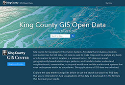
Our one-stop destination to find, inspect, download, and use King County GIS data.
- FTP data download
The King County GIS FTP Data Download Portal is no longer active.
Please use King County GIS Open Data to access the same content. You will find options to inspect data and to download it in CSV, KML, shapefile, and file geodatabase formats. Access to the data services via REST endpoint and GeoJSON is also available. For more information, see KCGIS Open Data's "How to use this site."
Need help? giscenter@kingcounty.gov
Responses: M-F, 8am-5pm.
Responses: M-F, 8am-5pm.
More King County data
- Data.KingCounty.gov
King County's Socrata site where you can access, view, and download any of more than a thousand datasets. - Elections data
Downloadable elections results and data requests. - Assessments data download
Extracts from the Assessments database available for direct download. - LocalScape
King County Department of Assessments community map and data portal. Includes downloadable data. - Metro Transit developer resources
Includes a link to Metro's GTFS (general transit feed specification) data files.