
 Translate
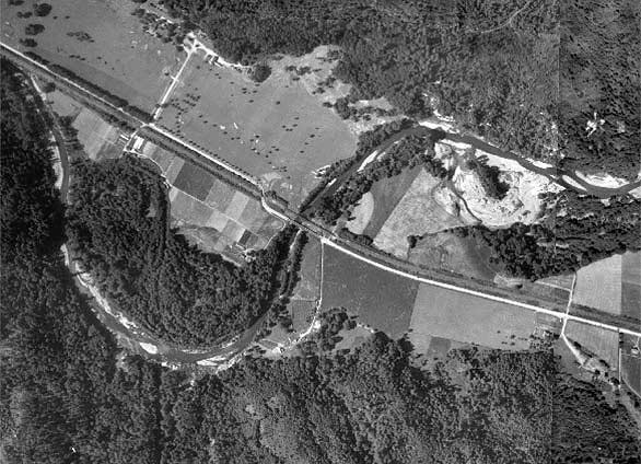
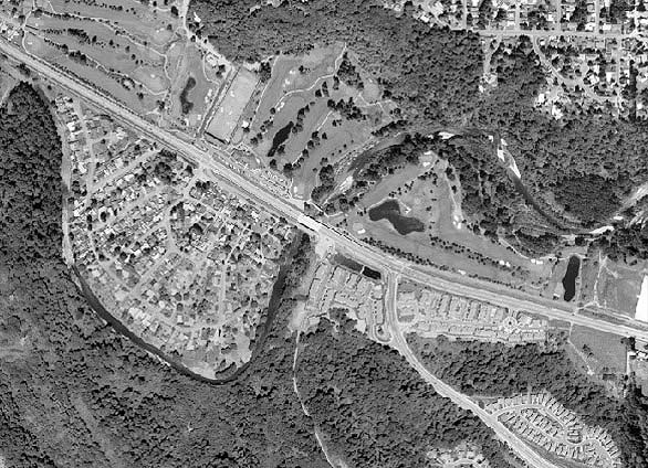
Example of historical shoreline changes on the Cedar River
Cedar River shoreline changes from 1936 to 2002
- Homes built at the water's edge and in the floodplain;
- Levees and revetments built to constrain the river and protect homes and a golf course from floods;
- Masonry dam impounded floodwaters to reduce peak flows and protect homes.
Ecological effects:
- The river flows like a chute and braided channels are gone, reducing diversity of riffle/pool habitat for aquatic life such as salmon, trout and the food chain on which they depend;
- Gravel bars are mostly gone, reducing succession of riverside plants and diversity of habitats for aquatic and terrestrial life;
- Proximity of houses increases the potential for sewage seeping or flowing unfiltered into the river from flooded or broken septic systems, feeding algae which, when they die and decay, deprive oxygen needed by other aquatic organisms.
- Proximity of yards and a golf course increases the unfiltered flow of pesticides, herbicides, soaps, fertilizers and other soluble contaminants into the river during rains and flood events, challenging survival of organisms that live in it.
1936
2002
For more information about shoreline management in King County, please contact Laura Casey, environmental scientist, Department of Local Services.