
 Translate
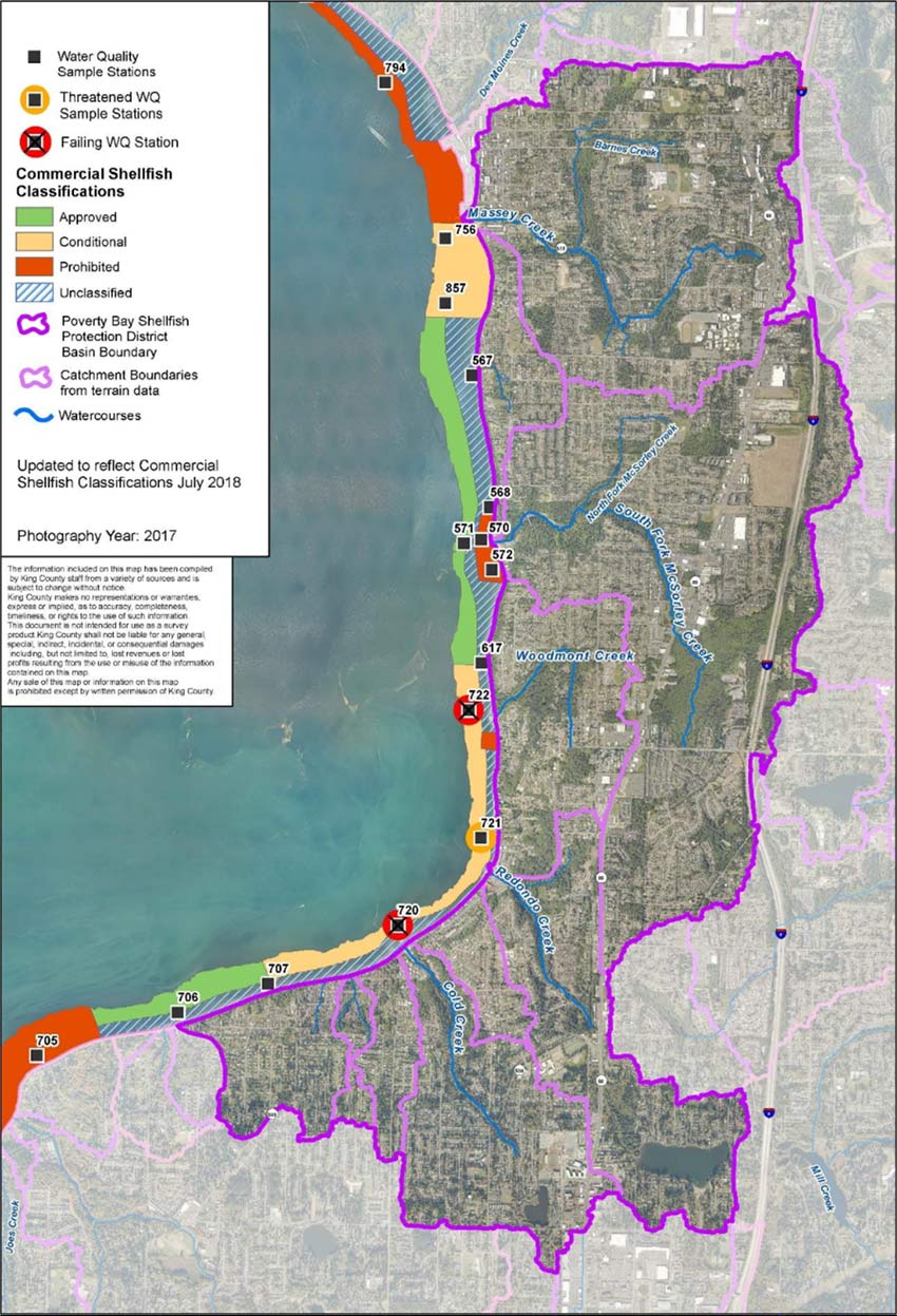
Poverty Bay Shellfish Protection District Map
The map below shows the Shellfish Protection District boundary. This district was approved by King County Council December 3, 2018 in accordance with RCW 90.72. The map includes existing shellfish harvesting beds, their harvest classification, and marine monitoring stations managed by Washington State Department of Health. In addition, the map identifies the primary watercourses and drainage areas within the Poverty Bay Shellfish Protection District boundaries.
This project has been funded wholly or in part by the United States Environmental Protection Agency under assistance agreement PC-00J88801 to the Washington State Department of Health. The Contents of this document do not necessarily reflect the views and policies of the Environmental Protection Agency, nor does mention of trade name or commercial products constitute endorsement or recommendation for use.