
 Translate
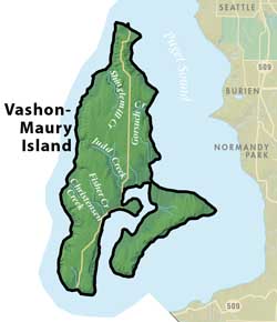
Vashon-Maury Island Groundwater Management Area
Vashon-Maury Island ground and surface waters provide all of the water needed for residential, commercial and agricultural needs. Water quality on Vashon-Maury Island is generally excellent. All drinking water sources on the island (springs, surface water, and groundwater) are supplied by local precipitation. Vashon-Maury Island was designated a Sole Source Aquifer by the United States Environmental Protection Agency in June 1994. The majority of the residents of Vashon-Maury Island get their drinking water from public water systems (PWS).
Vashon-Maury Island Groundwater Protection Committee
Groundwater Data
Vashon-Maury Island Groundwater Management Plan
Vashon-Maury Island Groundwater Maps
Vashon-Maury Island Watershed Plan
Groundwater Studies
Vashon-Maury Island Groundwater Monitoring
Learn about monitoring to assessing the status of Vashon-Maury Island water resources
The Vashon-Maury Island Water Resources Evaluation project was completed in 2010. This work assessed the water resources of the island and provided a better understanding of how different activities can adversely affect the island's water quality and quantity that lead to an updated, more accurate water supply budget for the island.
Vashon-Maury Island Marine Recovery Area
The Marine Recovery Area is a specific designation that establishes a goal of protect, preserve and restore shellfish harvest opportunities by assuring that property owners within the Marine Recovery Area inspect, and repair or replace as necessary, their On-Site Sewage (OSS) system.
Quartermaster Harbor Nitrogen Management Study
This 4 year (2009-2012) study evaluated the role of nitrogen in the risk of lethal, low-level dissolved oxygen events in Quartermaster Harbor (QMH), a sensitive marine embayment of Vashon-Maury Island (VMI) in Puget Sound.
Water Suppliers on Vashon-Maury Island
This Groundwater Management Area has 23 Group A and 124 Group B Public Water Systems. The majority of the residents in this GWMA are serviced by the following Water Utility service areas:
| Burton | KC Water District 19 |
| Dockton | Maury Mutual |
| Gold Beach | Westside |
| Heights |
This page is produced by the King County Groundwater Protection Program. To learn more about this group and its responsibilities, please read about the Groundwater Protection Program.