
 Translate
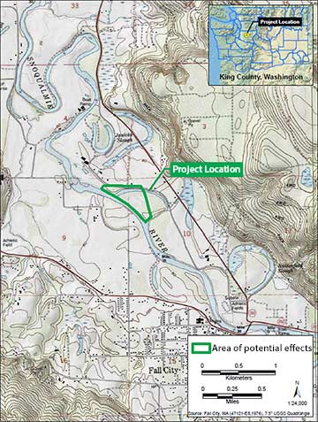
Upper Carlson floodplain restoration project
Snoqualmie-Skykomish Watershed
Purpose
The Upper Carlson floodplain restoration project was undertaken to restore critical habitat for threatened Chinook Salmon and Steelhead. The levee was built in the 1930’s to straighten and stabilize the Snoqualmie River, but along the way, it has impacted fish habitat and the processes that create and maintain those habitats. This project was intended to replace needed flood and erosion protection in a location and way that allows for restoring and sustaining high quality habitat in the river and floodplain.
Project description and intended outcome
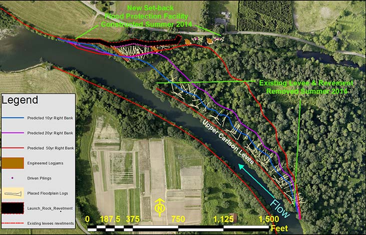
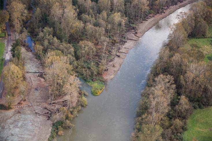
During the summer of 2014, the King County Water and Land Resources Division removed the 1600-ft long levee and revetment and constructed a new, 1200 foot-long revetment that was set-back along Neal Road (Figure 1). These actions have begun to restore natural river processes along this reach of Snoqualmie River and reconnect the river with 50 acres of forested floodplain. The project addresses high priority salmon habitat restoration needs for the threatened Snoqualmie Chinook populations identified in the federal Puget Sound Salmon Recovery Plan (2007) as well as for threatened steelhead, other salmon species and wildlife.
The set-back revetment includes four pile-based log structures and an angular rock revetment. The log structures are intended to protect Neal Road and private property from the river as it migrates across the newly unconstrained floodplain, while also providing high quality fish habitat. The log structures are backed by a new, 850-ft long rock revetment in the lower end of the site, providing added protection where the river is most likely to migrate.
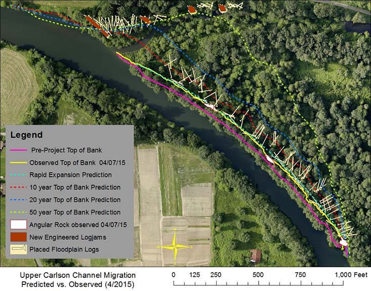
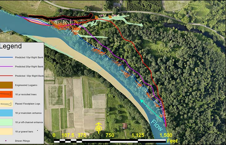
To gain access to remove the levee and large toe rock, about 300 trees were removed. They were felled with rootballs and as much of the trees’ length intact, and then placed in the floodplain adjacent to the levee removal area, where they will be recruited to the river as it migrates into the floodplain. As placed and standing trees fall into the river, large, complex logjams are expected to form throughout the project area - providing high quality edge habitat for salmon (Figure 2).
Removal of the levee and rock bank protection has allowed the channel to widen and begin to migrate and restored the river’s connection with its floodplain. Rapid channel widening is expected initially as the river recaptures its natural channel width; followed by a period of slower channel migration as wood falls in the river and slows migration through the right bank. These processes will form habitat features like gravel bars and logjams that were previously not present within the reach and will now provide spawning and rearing habitat for salmon.
Sixteen acres of knotweed were also treated across the 50-acre floodplain and the site is being planted with about 11,000 native trees and shrubs. Native fill material was provided to four permitted farm pads in the area to help protect farm animals, equipment and supplies during flooding and to reduce the project’s disposal costs.
King County is actively monitoring the way the project impacts flooding and salmon habitat. Monitoring is currently focused on understanding how the January 2015 flood event affected the project area and adjacent properties to ensure that pre-project predictions were correct and that flooding and erosion protection measures are adequate. This summer, monitoring will focus on how the river, floodplain, and associated aquatic habitat are responding to the levee removal. Monitoring will include mapping of habitat features, snorkel surveys for fish use, topographic and bathymetric mapping to document channel changes, and vegetation monitoring. Monitoring updates are expected after year 1, 3, 5 and 10 and after significant flood events.
Post-construction monitoring
Since the project was completed in October 2014, the channel has widened by an average of 40 feet and created over 1.5 acres of new aquatic habitat . More detailed survey work and monitoring is underway, and will provide a more complete picture of project effects on habitat, flooding and farming. That work, combined with continued outreach to neighbors, recreational users, and the agricultural community will help guide future restoration actions at this site and throughout the Fall City Reach of the Snoqualmie River.
Funding & partners
- Washington State Salmon Recovery Funding Board (SRFB) and Puget Sound Acquisition and Restoration (PSAR) via Washington Resource Conservation Office (RCO) and Puget Sound Partnership;
- National Oceanic and Atmospheric Administration (NOAA) via the Nature Conservancy;
- Coordinated Investment in Floodplains grant via the Washington State Department of Ecology (DOE) with support from The Nature Conservancy;
- U.S. Environmental Protection Agency via the Snoqualmie Tribe;
- King County Flood Control District via Cooperative Watershed Management Grant;
- King County Department of Natural Resources and Parks.
- Land was purchased with funding from King County Conservation Futures and SRFB.
Cost
- $3.5 million.
For more information about the Upper Carlson Levee Floodplain Restoration Project, please contact Mary Maier, Snoqualmie Basin Steward, WLR Watershed Stewardship.