
 Translate
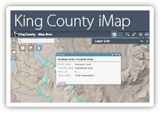
King County iMap
Interactive mapping tool
 LAUNCH
|
iMap is an application that allows you to view King County spatial information (GIS data and images) in an interactive map display. You can customize your map display to show just the information you want to see at the best scale for your chosen purpose. iMap is your window to a wealth of geographic information from throughout King County on such topics as real property, natural resources, political boundaries, planning, and much more. |
Mailbox monitored Monday through Friday, 8am–5pm.
Getting started with iMapSee also: iMap Help and iMap User Questions Search for a location Try entering an address into the Basic Search box in the upper left. One or more selection options may appear as you type. Basic Search can also find parcel numbers, street intersections (use an ampersand between street names like this: 80th & Roosevelt), and common destinations and landmarks, such as parks and schools. Look up property information Zoom to an address or parcel number using Basic Search, then click on a red-outlined parcel to see a pop-up with property information. (The parcels layer is turned on by default when you first launch iMap Beta.) Explore different map layers There are more than a dozen theme-based layer groups to choose from in the Layer List. (Look for the Layer List icon in the icon group in iMap’s title bar.) Expand a layer group by clicking on its name. Display or hide layer groups and individual layers by clicking the check boxes next to their names. Important: a layer group needs to be checked on in order to see any of the individual layers in that group display on the map. This PDF document lists all of the layers by name as they appear in iMap. Try different basemaps Changing the basemap that displays in the background of your map view is as easy as opening the Basemap Gallery and then clicking on one of the map thumbnail images. (Look for the Basemap Gallery icon in the icon group in iMap’s title bar.) In addition to a standard basemap made with authoritative King County data, there are several vintages of aerial photo imagery, a hillshade basemap that represents landforms, and several third-party basemaps, including OpenStreetMap. |