
 Translate
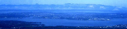
Cedar River - Lake Washington Watershed
The Cedar River - Lake Washington Watershed is the land area in which rainwater drains to Lake Washington and out through the Hiram Chittenden Locks. The Cedar River - Lake Washington watershed includes the Cedar River and its tributaries, May Creek, Coal Creek, Mercer Island, Mercer Slough, Kelsey Creek, Fairweather Creek, Yarrow Creek, Juanita Creek, Forbes Creek, Lyon Creek, McAleer Creek, Thornton Creek, Ravenna Creek and of course, Lake Washington.
The Sammamish Watershed drains into Lake Washington too, and is published on a separate page.; That drainage includes Swamp Creek, North Creek, Bear Creek and Little Bear Creek, Cottage Lake Creek, Evans Creek, Issaquah Creek, Tibbetts Creek and a number of smaller creeks draining to the east and west shores of Lake Sammamish.
For information about the area that is a source for City of Seattle's drinking water, please see Seattle's Cedar River Watershed page.
Cedar River Council
Public-private community group that promotes the health of the Cedar River Basin, focusing on lower basin issues.
Community service centers
Information about King County's satellite offices including the Black River community center in the Cedar River watershed at Renton. Office address is 900 Oaksdale Ave. S.W., Renton, WA 98055, phone number 206-296-7810. The Covington community service center is located at 27331 172nd Ave. SE, # 116, Covington, WA 98042, phone number 206-296-1387. The Northshore community service center is located at 10808 N.E. 145th St., Bothell, WA 98011, phone number 206-296-9840.
Basin Steward Program
Find out what Water and Land Resources' Basin Steward Program does and how to contact your Basin Stewards.
River warnings
- Hazards in King County rivers
Overview of risks associated with river-related recreation and resources for water, boating and river safety.
Projects in the Cedar River - Lake Washington Watershed
Water and land improvement projects, Cedar River - Lake Washington Watershed
Look up flooding, wastewater treatment and stormwater projects in King County, Washington.
- Lower Bear Creek Natural Area Habitat Enhancement Project
- May Creek Tributary 291A Small Stream Basin Retrofit
Flooding and hydrology
Look up real time gage data, flood stage info and learn what it means along the Cedar River.
Cedar River flood level viewer
Interactive map showing flood depths at various flood levels.
Hydrologic gage data map
Look up detailed gaging station data for creeks and rivers in the region.
Surface water management and groundwater
Report problems: drainage and water quality
Stormwater runoff pollution and how to reduce it
Tips on how to reduce water pollution from home, yard, car, pets and so forth.
This page offers everything we have about the lake, its environment and recreational information.
Lake Union water quality information
Swimming beach data
Find information about levels of bacterial pollution and relative human health risks at swimming beaches on Lake Washington, Lake Sammamish, and other King County lakes.
The Restore and Protect Project
Project to identify habitat stressors and recommend restoration and protection actions to improve freshwater quality and aquatic habitat in Puget Sound streams including Rock Creek in the Cedar River Watershed.
Stormwater runoff pollution and how to reduce it
Rainstorms rinse the watershed faster when covered by hard surfaces like roofs and roads. Learn how stormwater brings pollution, wastes and sediments into streams, rivers and lakes and how you can keep stormwater clean.
Pollution monitoring
Rivers and streams: ongoing water quality sampling in Lake Washington streams and rivers. Water quality data are available online for:
- Cedar River
- Coal Creek
- Fairweather Creek
- Forbes Creek
- Juanita Creek
- Kelsey Creek
- Lyon Creek
- May Creek
- McAleer Creek
- Thornton Creek
- Yarrow Creek
- Information for creeks draining to Lake Washington from the the Sammamish River are available from the Sammamish Watershed page.
Lakes: statistics and water quality
- Bitter Lake
- Boren Lake
- Lake Desire
- Echo Lake
- Forbes Lake
- Lake Francis
- Green Lake
- Haller Lake
- Lake Kathleen
- Shadow Lake
- Shady Lake
- Spring Lake
- Lake Twelve
- Walsh Lake
- Webster Lake
Lake Weedwatcher Program
Got a small boat? Interested in saving a lake from the horrors of dense weed infestations?
Cedar River - Lake Washington Watershed map
Drainage map displaying streams, lakes, drainage divides, major roads and cities in the area that drains to Lake Washington and out the Hiram M. Chittenden Locks, except for the Sammamish Watershed area. The map is in Acrobat format. File size is 445 Kb.
South King County Groundwater Management Area
Learn about plans to protect the aquifer in the south county area including the Cedar River watershed localities of Renton, Black Diamond, Maple Valley, and areas in between.
Lower Cedar River Basin Planning documents
- Current and Future Conditions Report (13.8 Mb Acrobat pdf), April, 1993
- Current and Future Conditions Summary Report (10 Mb Acrobat pdf), October, 1993
- Lower Cedar River Basin and Nonpoint Pollution Action Plan (13.9 Mb Acrobat pdf), July, 1998
- Lower Cedar River Basin Plan summary
An overview of the issues and recommendations in the Basin Plan
Urbanization of Aquatic Systems: Degradation Thresholds, Stormwater Detection and the Limits of Mitigation (Acrobat pdf, external)
King County study concluding that "approximately 10 percent effective impervious area in a watershed typically yields demonstrable, and probably irreversible, loss of aquatic-system function."
Salmon recovery
For salmon viewing and fishing access, please refer to the recreation and appreciation section below.
WRIA 8 salmon recovery - Lake Washington, Cedar River, and Sammamish
Multi-jurisdictional site provides news and data about the recovery of threatened salmon species in the Sammamish, Lake Washington, and Cedar River drainage area and provides an overview of the planning process, scientific information, and meeting records.
Story Map: Salmon Recovery in the Lake Washington/Cedar/Sammamish Watershed (WRIA 8)
Map of efforts to restore habitat for Chinook salmon, representing a variety of habitat types within the WRIA 8 administrative area.
Greening your Shoreline
References and recipes for lakeshore property owners on Lake Washington and Lake Sammamish to use to improve shorelines for people and salmon.
WRIA 8 plans, studies and maps
- Final WRIA 8 chinook salmon conservation plan
Cedar River, Sammamish, Lake Washington - Chinook Conservation Plan Implementation Progress Report, 2011
State of the Chinook salmon populations, the watershed, and efforts to implement the WRIA 8 Chinook Conservation Plan during the first five years (2005-2010). - WRIA 8 Land Cover Change Analysis, 2011 (2.3 Mb Acrobat pdf)
Known freshwater distribution of salmon and trout
Draft maps showing chinook, coho, cutthroat trout, kokanee, sockeye, and steelhead distribution in the greater Lake Washington watershed (WRIA 8), based on the collective personal knowledge of resource professionals and data gathered from published and unpublished databases.
Wastewater treatment

Major improvements to the sewage treatment system serving King and Snohomish Counties including the Cedar/Lake Washington watershed area. The Brightwater system encompasses a new treatment plant, its associated conveyance pipes, outfall to Puget Sound and an environmental education center.
Juanita Bay pump station replacement project
Details about a project to to increase wastewater handling capacity and ensure safe and reliable operation.
Recreation and appreciation
Cedar River Recreation Study
Report describing the primary boating and floating areas along the Cedar River and characterization of the floating experience for recreational users.
Lake Shorelines, Life on the Edge Video Series
Watch a video that describes lakes in King County and how residents value them, with ideas that shoreline landowners may like to apply to help preserve the quality of lakes and lake ecosystems.
Salmon SEEson - salmon viewing
Look up locations to view the fall migration of salmon returning to native streams in the greater Lake Washington Watershed and Central Puget Sound drainages.
Cedar River public boating and fishing access
Find parks, ecological natural areas and boat ramps to access the river for swimming, fishing and boating. Includes lands managed by the City of Renton, King County and City of Seattle.
King County Natural Areas:
Look up individual properties protected in King County's open space system for their ecological and working resource values. The natural lands site provides addresses, pictures, location maps and rules for public use:
- Belmondo Reach Natural Area
- BN Peninsula Natural Area
- Cavanaugh Pond Natural Area
- Cedar Grove Road Natural Area
- Cemetery Reach Natural Area
- Crow Marsh Natural Area
- Dorre Don Reach Natural Area
- Lake Desire (& Site 2) Natural Area
- Landsburg Reach (incl. Big Bend Natural Area)
- Lower Lions Reach Natural Area
- Lower Peterson Creek Corridor Natural Area
- May Valley 164th Natural Area
- Mouth of Taylor Reach Natural Area
- Peterson Lake Natural Area
- Rainbow Bend Natural Area
- Ravensdale Retreat Natural Area
- Ricardi Reach, Jones Reach, Cedar Grove Natural Areas
- Rock Creek Natural Area
- Wetland 79 Natural Area
Cedar River trail
The Cedar River trail follows an old railroad right-of-way from downtown Renton to King County's Landsburg Park, alongside the scenic Cedar River. A branch of the trail connects with King County's Lake Wilderness Park and continues to Four Corners.
Known hazards on King County rivers
Reports of confirmed logjams and obstructions that pose a hazard to recreational river users, but does not include hazards that are not known.
Fishing regulations and seasons (external link)
Washington Dept. of Fish and Wildlife fishing rules for Washington State including Lake Washington, its tributaries and Cedar River.
Lands
Quality assurance project plan for regulatory effectiveness monitoring for developing rural areas
Framework to monitor and evaluate land use regulations to help ensure their effectiveness, using indicators for hydrology, water quality, biology, and stream complexity.
Noxious weed infestation map
Interactive map showing location of regulated noxious weed infestations.
2008 Cedar River Coordinated Knotweed Project Report (68 Kb Acrobat pdf)
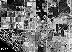
Aerial photos from the 1930's, 1970's and 1990's illustrating growth of Bellevue in the East Lake Washington basin and Fairwood in the Cedar River basin, among other areas in King County.
Related information
- King County watersheds map
- Lakes in King County, Washington
- Puget Sound marine topics
- King County environment
Related agencies
- Dept. of Natural Resources and Parks
- Water and Land Resources Division
- Wastewater Treatment Division
- Parks and Recreation Division