
 Translate
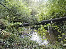
Lower Bear Creek Natural Area
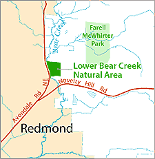
The site contains both mature, upland forest and areas of wetland associated with Bear Creek. About half of the property is located within the 100-year floodplain of Bear Creek. The site contains habitat for a variety of fish and wildlife species.
- The goals for the Lower Bear Creek Natural Area are 1) to conserve and enhance the ecological value, and 2) accommodate appropriate public uses that do not harm ecological resources.
The Lower Bear Creek Natural Area Site Management Guidelines are available in Adobe Acrobat format, in sections for faster download. For help using Acrobat files, please visit our Acrobat help page.
Download Here:
Lower Bear Creek Natural Area Site Management Guidelines