
 Translate
Porter Reach Restoration Project
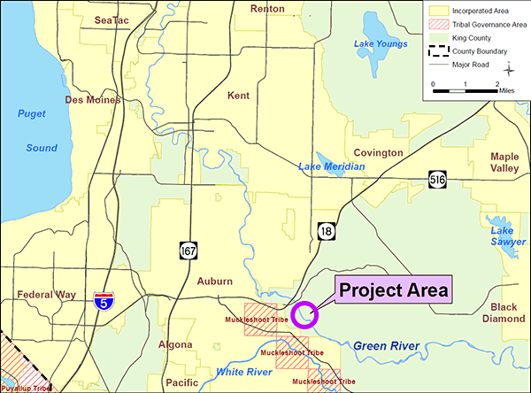
Green River Watershed
Project overview
The Porter Reach Restoration Project was a habitat restoration project along the Green River designed to benefit salmon, particularly chinook and steelhead, which are both listed as threatened under the federal Endangered Species Act.
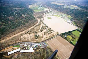
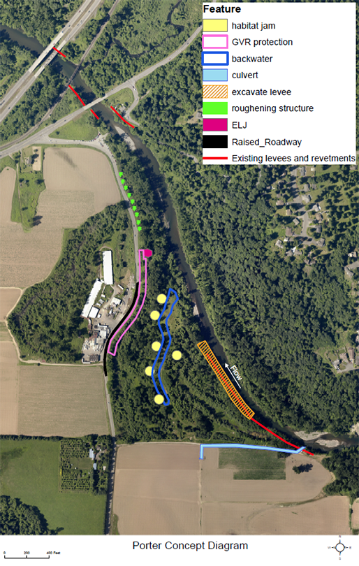
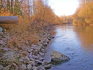
An old levee prevented the river from flowing across the floodplain, which had greatly reduced fish habitat in this reach. King County removed about 60 percent of the levee, allowing the river to traverse the floodplain in a more dynamic flow pattern and create natural habitat complexity for fish and wildlife. A backwater channel was constructed to promote the rearing of young fish. Large wood was installed in the floodplain to increase habitat for salmon and wildlife such as amphibians and small mammals.
Approximately 970 feet of Green Valley Road was raised to reduce localized flooding on and near the road and reduce the incidence of road closures. Raising the road also improved the flood containment function of an existing berm and reduced construction impacts to adjacent wetland.
Construction was performed from summer of 2017 through winter of 2018.
Project location
The Porter Reach is located in the Porter Levee Natural Area, a King County Parks property in rural King County east of the City of Auburn. The project site is on the west bank of the Green River upstream from Highway 18.
Construction elements
- More than half of the levee was removed (900 feet of the 1,500-foot levee) allowing the river to traverse the floodplain.
- A 1,000-foot backwater channel was built away from the river within the floodplain to promote salmon smolt rearing in an area protected from high-velocity flows of the river.
- Large wood was installed in the floodplain to increase habitat and diversity for fish and wildlife.
- A culvert was placed to improve drainage from an adjacent farm field and improve agricultural productivity.
- Approximately 970 feet of Green Valley Road was raised to reduce localized flooding.
- Native trees and shrubs were planted on portions of the property to enhance fish and wildlife habitat.
Project benefits
The primary ecological goal of the project was to improve rearing habitat for salmon and trout. Puget Sound Salmon Recovery Plan and the Green/Duwamish and Central Puget Sound Watershed Salmon Habitat Plan indicates that the primary factor limiting salmon and trout populations in the Green River is rearing habitat. The existing levee prevents the river from flowing across the floodplain which reduces fish habitat availability in this reach of the river. Removing a large portion of the levee will allow the river to flow across the floodplain and create more dynamic habitat, and in particular, rearing habitat. This project also includes working with farmers near the Porter Levee to improve drainage for agricultural production.
Project timeline
|
Benchmark |
Status |
|---|---|
|
Acquisition |
Complete |
|
Planning and preliminary design |
Complete |
|
Final design and permitting |
Complete |
|
Construction |
Complete |
Project documents
- SEPA Environmental Checklist Addendum (1.35 Acrobat pdf)
- Determination of Non-Significance (129 KB Acrobat pdf)
Project funding
- Floodplains by Design Partnership.
- King County Water and Land Resources Division.
- Washington State Salmon Recovery Funding Board.
- King County Flood Control District.
- Water Resources Inventory Area (WRIA) 9, referred to as Green/Duwamish and Central Puget Sound Watershed.
Contact
Fauna Nopp, Landscape Architect, Project Manager
King County Dept. of Natural Resources and Parks
206-477-4787
fauna.nopp@kingcounty.gov
For more information about the Porter Levee Setback and Floodplain Restoration Project, please contact Fauna Nopp, project manager, Ecological Restoration and Engineering Services Unit.