
 Translate
Green River Watershed
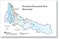
The Green River Watershed is the land area where rainwater drains to the Green-Duwamish River. The watershed includes Black River, Springbrook Creek, Mill Creek, Soos Creek, Jenkins and Covington Creeks, Newaukum Creek, Crisp Creek, and other tributaries. This page provides information specific to the Green-Duwamish Watershed while information spanning multiple watersheds may be found on our King County watersheds information page.
For information about the area that is a source for City of Tacoma's drinking water, please see Tacoma Public Utility's Green River Watershed page (external).
Basin Steward Program
Find out what Water and Land Resources' Basin Steward Program does and how to contact your Basin Stewards.
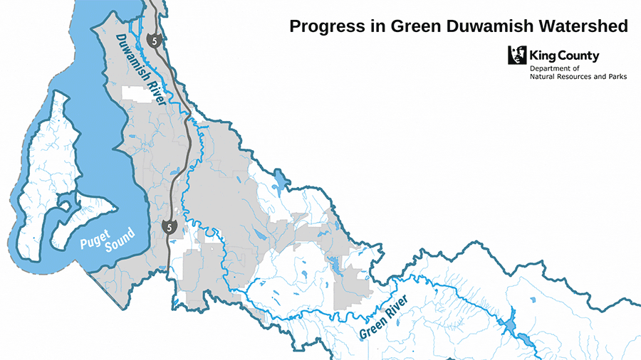
Green/Duwamish Watershed Strategy
Visit Our Green/Duwamish Blog (external) and learn more about the Green/Duwamish Watershed Strategy.
Notice of boating hazards
Sign up for river hazard updates:
Hazards in King County rivers
Overview of risks associated with river-related recreation and resources for water, boating and river safety.
Projects in the Green River Watershed
Water and land improvement projects, Green River Watershed
Use a map to locate projects related to flooding, wastewater treatment and stormwater in King County, Washington.
Flooding and hydrology
 Green River flooding information
 Look up real time gage data, flood phase/ river crest descriptions and learn what high water means to you along the Green-Duwamish River.
- Green River Web cam near Auburn, Washington (external link)
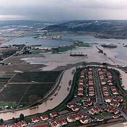
Flood photo viewer
Use a map to look up photographs of past floods on the Green River and other rivers in King County.
Hydrologic gage data map
Look up detailed gaging station data from area creeks and rivers.
Precipitation near Howard Hanson Dam, Green River (external link)
Precipitation monitoring station data, map, and graphs courtesy of the Office of the Washington State Climatologist.
Duwamish Waterway cleanup
Find pollution-related information below under Surface water and groundwater.
Duwamish Waterway superfund cleanup programs
Accomplishments to restore the Duwamish Waterway, timeline, major milestones, approaches and participants, and how to prevent future pollution.
Sediment remediation projects
Cleanup of contaminated sites in the Duwamish Waterway and Elliott Bay to enhance and restore habitat for aquatic life.
Salmon recovery
WRIA 9 salmon recovery:
Green/Duwamish River
This page provides information about the recovery of threatened salmon species in the Green/Duwamish drainage area including an overview of the planning process, scientific information, and meeting records. We welcome your participation.
- WRIA 9 Watershed Ecosystem Forum for Salmon Habitat Recovery
- Upper Green River Subwatershed
- Volunteer for salmon recovery in the Green - Duwamish Watershed
- WRIA 9 Plans, Studies and Maps
- WRIA 9 salmon habitat plan
Green/Duwamish River and Central Puget Sound Watershed - WRIA 9 Implementation Progress Report
- Updates and analysis about the WRIA 9 marine shoreline condition, freshwater conditions and landcover.
- Riparian Shade Characterization Study
Summary of field work and analyses conducted as part of the Green-Duwamish Water Quality Assessment: Riparian Shade Characterization Sampling and Analysis Plan (King County 2004)
Related salmon recovery documents may also be found on the Central Puget Sound Watershed page.
- WRIA 9 salmon habitat plan
Salmon recovery by subwatershed
Surface water and groundwater
Report problems: drainage and water quality
The Restore and Protect Project
Project to identify habitat stressors and recommend restoration and protection actions to improve freshwater quality and aquatic habitat in Puget Sound streams including Soos, Cristy and Newaukum Creeks in the Green River Watershed.
Tips on how to reduce water pollution from home, yard, car and pets
Green River Stormwater Retrofit Planning Project
Project to develop best practices for stormwater management, to improve local drainage techniques to meet future in-stream flow conditions and water quality goals in the Green-Duwamish River Watershed.
Green-Duwamish River watershed map
Drainage map displaying streams, lakes, drainage divides, and major roads in the area that drains to the Duwamish waterway and into Elliott Bay. The map is in Acrobat format. File size is 941 Kb.
- Hamm Creek aerial photo map (1.4 Mb Acrobat pdf)
Detailed map showing drainage and open channels for Hamm Creek as of 1998.
South King County groundwater management area
Learn about plans to protect the aquifer in the south county area including the Green-Duwamish watershed localities of Renton, Kent, Auburn, Covington, Black Diamond, Maple Valley, Tukwila, and areas in between.
Benthic Macroinvertebrate Study of the Greater Lake Washington and Green-Duwamish River Watersheds Reports
This report summarizes benthic macroinvertebrate data collected from a total of 130 sites in 20 sub-basins in the Green Duwamish River and Greater Lake Washington watersheds during August and September 2003 and 2003.
Green-Duwamish River Watershed quality assessment
Comprehensive study of the Green-Duwamish River water quality and the land area draining to it, to help guide policy, prioritize cleanup and restoration efforts, and protect salmon stocks from depletion.
Green-Duwamish Microbial Source Tracking Report
This report describes the results of a microbial source tracking project on the Green River.
Stormwater runoff pollution and how to reduce it
Rainstorms rinse the watershed faster when covered by hard surfaces like roofs and roads. Learn how stormwater brings pollution, wastes and sediments into streams, rivers and lakes and how you can keep stormwater clean.
Lake information
Lake weedwatcher project
- Angle Lake
- Clark Lake
- Deep Lake
- Lake Dolloff
- Lake Fenwick
- Lake Geneva
- Grass Lake
- Horseshoe Lake
- Jones Lake
- Lake Lucerne
- Lake Meridian
- Lake Morton
- Lake Neilson (Holm)
- North Lake
- Panther Lake
- Pipe Lake
- Ravensdale Lake
- Lake Retreat
- Lake Sawyer
- Star Lake
- Walker Lake
- Lake Wilderness
Pollution monitoring
Ongoing water quality sampling in the Duwamish Waterway, Green River and tributary creeks. Current water quality data are available for:
- Crisp Creek
- Green - Duwamish River
- Longfellow Creek
- Mill Creek
- Newaukum Creek
- Soos, Jenikins and Covington Creeks
- Springbrook Creek
Endocrine disrupting chemicals in the environment
Learn about these natural and synthetic chemicals flushed daily into our waters, and discover what King County is doing to protect public health and the environment as the science and our understanding of endocrine disruptors develops.
Wastewater treatment
South Treatment plant An overview of King County's wastewater treatment plant on the Duwamish River at 1200 Monster Road SW Renton , WA 98057. Directions
Combined Sewer Overflow Control Program
During heavy rainstorms, our combined sewers may exceed their capacity and the mixture of untreated sewage and stormwater is allowed to overflow into the Duwamish River and other water bodies to keep it from backing up into homes and businesses. Learn how King County is working to improve our system to control overflows.
Combined sewer overflow water quality assessment
Analysis of water and sediment quality in the Duwamish River and Elliott Bay to use as a basis for cleanup and restoration projects.
Recreation and appreciation
King County natural areas:
Look up individual properties protected in King County's open space system for their ecological and working resource values. The natural lands site provides addresses, pictures, location maps and rules for public use:
- Auburn Narrows Natural Area
- Bass Lake Natural Area
- Big Spring Creek/Newaukum Creek Natural Area
- Bingaman Pond Natural Area
- Covington Natural Area
- Flaming Geyser Natural Area
- Green River Natural Area
- Hamm Creek Natural Area
- Hatchery Natural Area
- Horsehead Bend Natural Area
- Kanaskat Natural Area
- Little Soos Creek Wetlands Natural Area
- Neely Bridge Natural Area
- Porter Levee Natural Area
Interurban trail
Green River trail
The Interurban Trail is a historic rail line that runs 14 miles through Tukwila, Kent, Auburn, Algona and Pacific. The Green River Trail runs 19 miles and provides excellent views and access to the Green River and surrounding river valley from Cecil Moses Park near Seattle to North Green River Park in Kent.
Soos Creek trail
The Soos Creek Trail features a gentle grade in a natural setting suitable for leisurely strolls, bicycle rides and horse rides.
Fishing regulations and seasons (external link)
Washington Dept. of Fish and Wildlife fishing rules for Washington State including Green/Duwamish River, its tributaries and lakes within the watershed.
Known hazards on King County rivers
Reports of confirmed logjams and obstructions that pose a hazard to recreational river users, but does not include hazards that are not known.
Lands
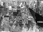
Aerial photos from the 1930's, 1970's and 1990's illustrating growth around Lake Meridian in the Soos Creek drainage, among other areas in King County.
Agriculture services and information
Comprehensive information related to agriculture in King County including parts of the Green River Watershed.
- FARMS Report - Future of Agriculture Realizing Meaningful Solutions
Report describes the findings of a study that determining what measures King County and other agencies should take to ensure the continued success of local agriculture.
Forestry
Comprehensive information related to forestry across King County including parts of the Green River Watershed.
Green-Duwamish Cooperative Weed Management Area (CWMA) Knotweed Project annual reports
Noxious weed infestation map
Interactive map showing location of regulated noxious weed infestations.
Green River Watershed facts:
- Watershed Size: 492 square miles
- River Length: 65 miles from Elliott Bay to Howard Hanson Dam
- Population: Approx. 400,000
- Salmon Species Present: Chinook, chum, coho, winter steelhead
- Other Interesting Wildlife: Elk, black bear, cougar, bald eagle, osprey, blue heron
- Number of Dams - two:
- Howard Hanson Dam, Built 1962 and
- Tacoma Water Supply Diversion Dam, Built 1911